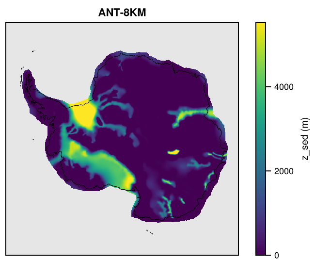
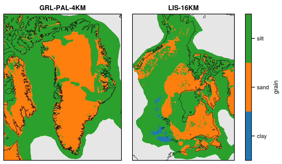
Sediment thickness (m) from global and regional maps, and sediment properties of North America and Greenland, remapped onto the grids of the domains and onto global lon-lat grids. Sediment is a thematic dataset made by remapping (see Gridded data): its products are defined in Sediment/remap.toml.
Products
Product
Source
Fields
Domains
Sediment-CRUST1
Laske et al. (2013): CRUST1.0, 1° global crustal model, land and ocean (igppweb.ucsd.edu/~gabi/crust1.html); its sediments are those of Laske and Masters (1997), the global sediment map of the v1 product SED-L97, which it replaces
Antarctica, GreenlandPaleo, Greenland, North, Laurentide, Eurasia, Global
Sediment-ANTASed
Baranov et al. (2021): ANTASed, 0.1° (11 km) map of the Antarctic continent (grounded ice and ice shelves, missing in the ocean), doi:10.3389/feart.2021.722699
z_sed
Antarctica
Sediment-Gowan2019
Gowan et al. (2019): 5 km maps of the surface sediments of North America, Greenland and Iceland (areas of the former ice sheets; missing elsewhere), doi:10.1594/PANGAEA.895889; the v1 product SED-G19
grain (1 clay, 2 sand, 3 silt), distribution (1 blanket, 2 veneer, 3 rock), composite (0-8, both combined); classes
GreenlandPaleo, Greenland, Laurentide
On the mountain-glacier domains (Pyrenees, Patagonia, Himalaya), on their 2 km grid: Sediment-CRUST1 and Sediment-ECM1, and Sediment-GlobSed on Patagonia (ocean only); their nests and crops get these by cropping (see Nests and crops).
Each file <GRID>_Sediment-<Source>.nc also has f_valid, the fraction of each cell covered by the source. Each source is remapped conservatively; on grids finer than the source it is then smoothed with a Gaussian of half the source spacing. CRUST1.0 contains the sediment map of Laske and Masters (1997) (A Global Digital Map of Sediment Thickness, EOS Trans. AGU, 78, F483; igppweb.ucsd.edu/~gabi/sediment.html) unchanged: on its 1° grid, the total thickness and the three layers agree with the original files (sedmap.map, map1.thk1-3) to within 0.01 km, the rounding of the stored values. The classes of Gowan et al. (2019) are remapped as classes: each cell gets the class that covers most of it. The global attribute remap_method records what was done on each grid.
Precision
The float fields are rounded on output to a tolerance by kind (see Precision and file sizes): the thicknesses (z_sed*) to 0.01 m; f_valid to 0.001. The classes of Gowan2019 are exact.
Licences
Source
Licence
Laske et al. (2013), CRUST1.0
No licence stated (cite Laske et al., 2013, and the REM web site); publishing assumed to be allowed
Straume et al. (2019), GlobSed v3
CC BY 4.0 (PANGAEA, doi:10.1594/PANGAEA.982339)
Mooney et al. (2023), ECM1
No licence stated (web site; article under Elsevier standard terms); publishing assumed to be allowed
Baranov et al. (2021), ANTASed
No licence stated for the data file (IEPT RAS web site; article CC BY 4.0); publishing assumed to be allowed
Gowan et al. (2019)
CC BY 4.0 (PANGAEA, doi:10.1594/PANGAEA.895889)
Making the dataset
julia-t 8 fesmdata.jl remap Sediment
See GHF for making single products and adding a source.
Downloads
Download the files with fesmdata.jl into $FESMDATA_PRODUCTS/<Domain>/<GRID>/ (see Download), or one by one from the links below. All released datasets are listed under Products.
Global
Version 2.2.1 (2026-10-16, packages). 18 files, 104.7 MB.
julia fesmdata.jl fetch Sediment Global     # all grids
julia fesmdata.jl fetch Sediment GLOBAL-5DEG     # one grid
These nests and crops get products of Sediment by cropping those of the domain (or crop) that contains them: fetch downloads these and cuts them (see Nests and crops), e.g. julia fesmdata.jl fetch Sediment Amery.