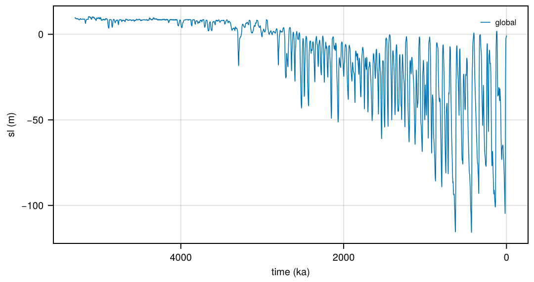
SeaLevel: global sea level over glacial cycles
Reconstructions of global (mean or eustatic) sea level over glacial cycles, some with the contributions of the ice sheets: stacks and regressions of benthic δ18O, inverse modelling of ice sheets, the Red Sea record, and the ice sheets of PaleoMIST 1.0. SeaLevel is a records dataset (non-gridded data, see Records): its products, defined in SeaLevel/records.toml, are prepared files in the form of the CF discrete sampling geometries, written to $FESMDATA_PRODUCTS/Records/SeaLevel/SeaLevel-<product>[-<part>].nc, each with its text form (.txt). Relative sea level indicators at sites are in RSL.
Products
| Product | Source | Variables | Time |
|---|---|---|---|
SeaLevel-Spratt2016 |
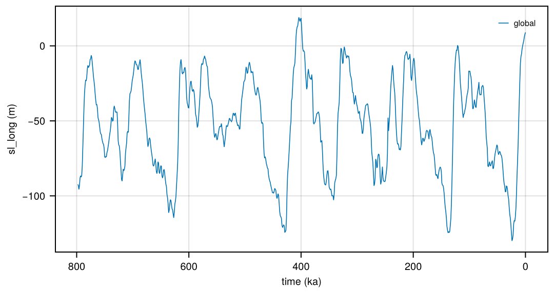
Spratt and Lisiecki (2016): sea-level stacks, doi:10.25921/rd66-5820 | sl_short (7 records, 0-430 ka), sl_long (5 records, 0-798 ka), each with _sd, _min, _max (95%) |
0-798 ka, 1 kyr (LR04) |
SeaLevel-Waelbroeck2002 |
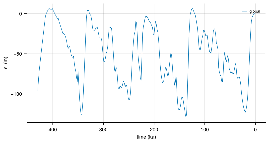
Waelbroeck et al. (2002): from benthic δ18O, doi:10.25921/08dt-1228 | sl, sl_min, sl_max, d18O_sw with its range; alternate age models |
0.5-430 ka, 1.5 kyr |
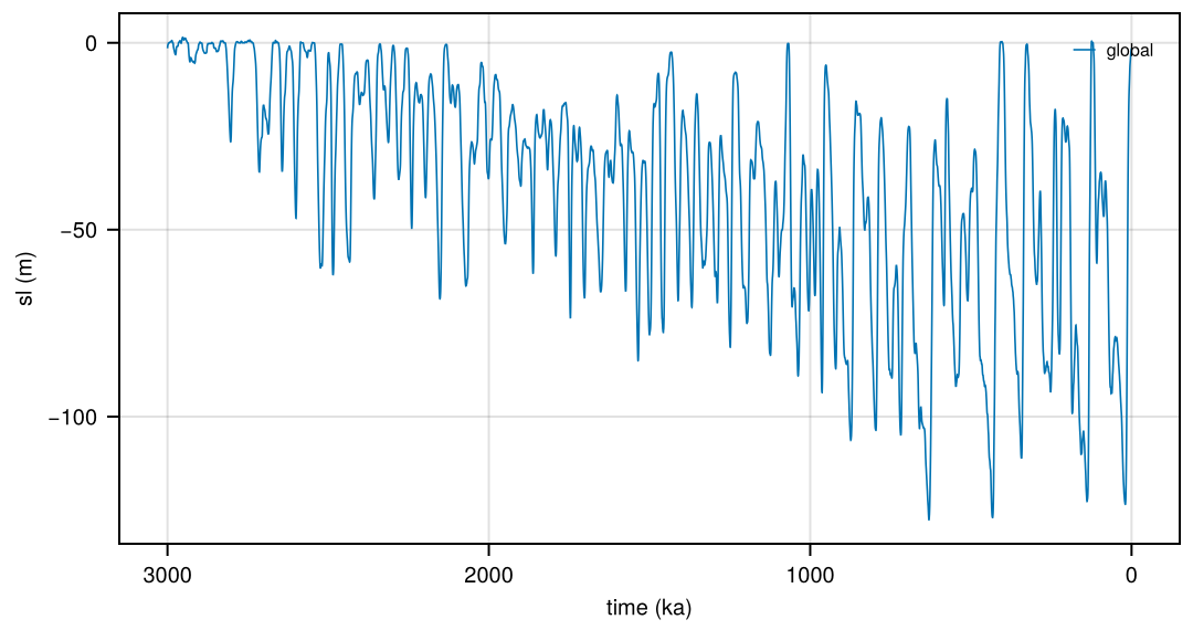
SeaLevel-Bintanja2008 |
Bintanja and van de Wal (2008): inverse modelling, doi:10.25921/revb-da37 | sl, sl_nam, sl_eas, tas_anom_nh, t_deep_anom, d18O_benthic, d18O_ice, d18O_temp |
0-3 Ma, 100 years |
SeaLevel-deBoer2014 |
de Boer et al. (2014): inverse modelling with four ice sheets, doi:10.25921/xs31-nt56 | sl, sl_eis, sl_nais, sl_ais, sl_gris, tas_anom_nh, d18O_benthic, d18O_sw, d18O_temp, V_ais, D_ais |
0-5.3 Ma, 100 years |
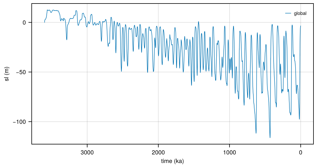
SeaLevel-Berends2021 |
Berends et al. (2021): coupled ice-sheet-climate model, doi:10.5281/zenodo.3793592 | sl, sl_min, sl_max, co2, co2_min, co2_max (three simulations) |
0-3.6 Ma, 100 years |
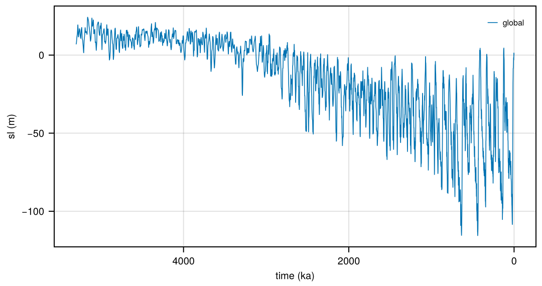
SeaLevel-Rohling2021 |
Rohling et al. (2021): regression on the LR04 stack, doi:10.25921/rq2y-4k67 | sl, sl_lis, sl_eis, sl_ais, sl_gris, d18O_benthic, d18O_sw, d18O_temp, t_deep_anom |
0-5.3 Ma, 1 kyr (LR04) |
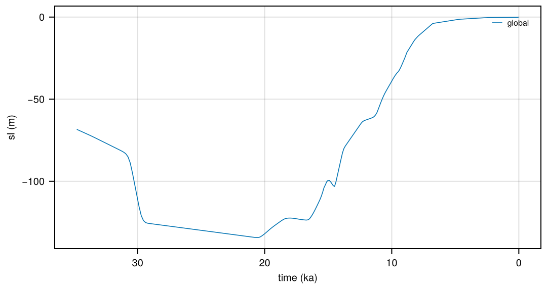
SeaLevel-Lambeck2014 |
Lambeck et al. (2014): ice-volume equivalent sea level from sea-level indicators and glacial isostatic adjustment, doi:10.1073/pnas.1411762111 | sl, sl_sd, sl_nominal |
0-35 ka, 326 values |
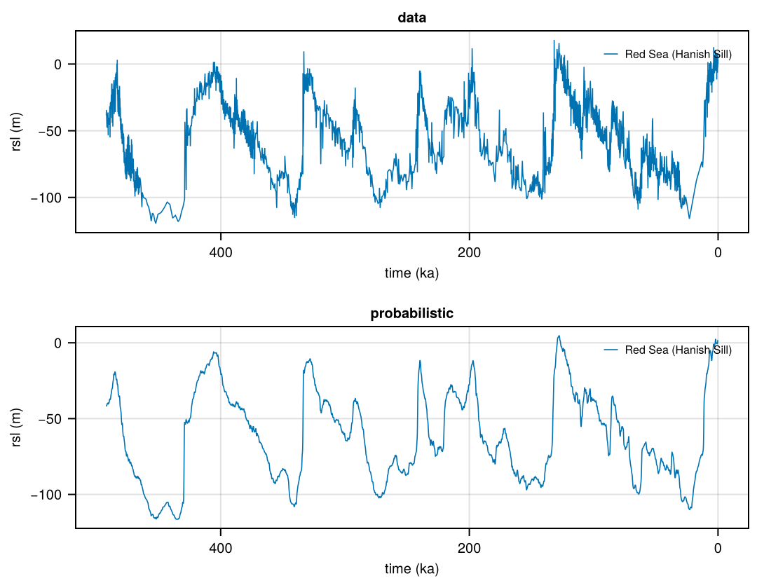
SeaLevel-Grant2014-<part> |
Grant et al. (2014): Red Sea relative sea level, doi:10.1038/ncomms6076; parts probabilistic and data |
rsl, rsl_min, rsl_max (95%), rsl_data_min, rsl_data_max, drsl with its range; data: rsl of the data points |
0-492 ka, 125 years; data points |
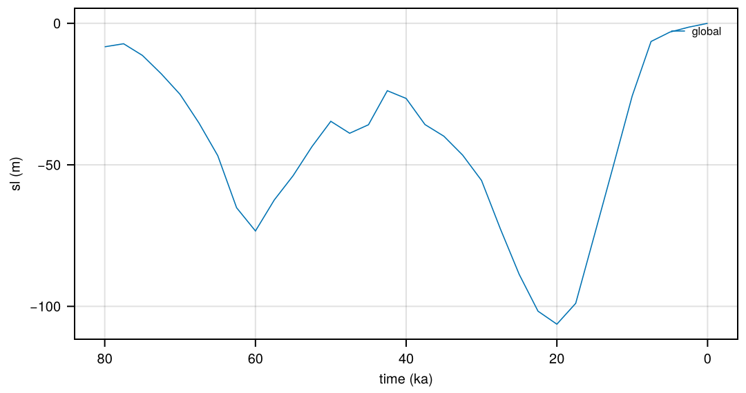
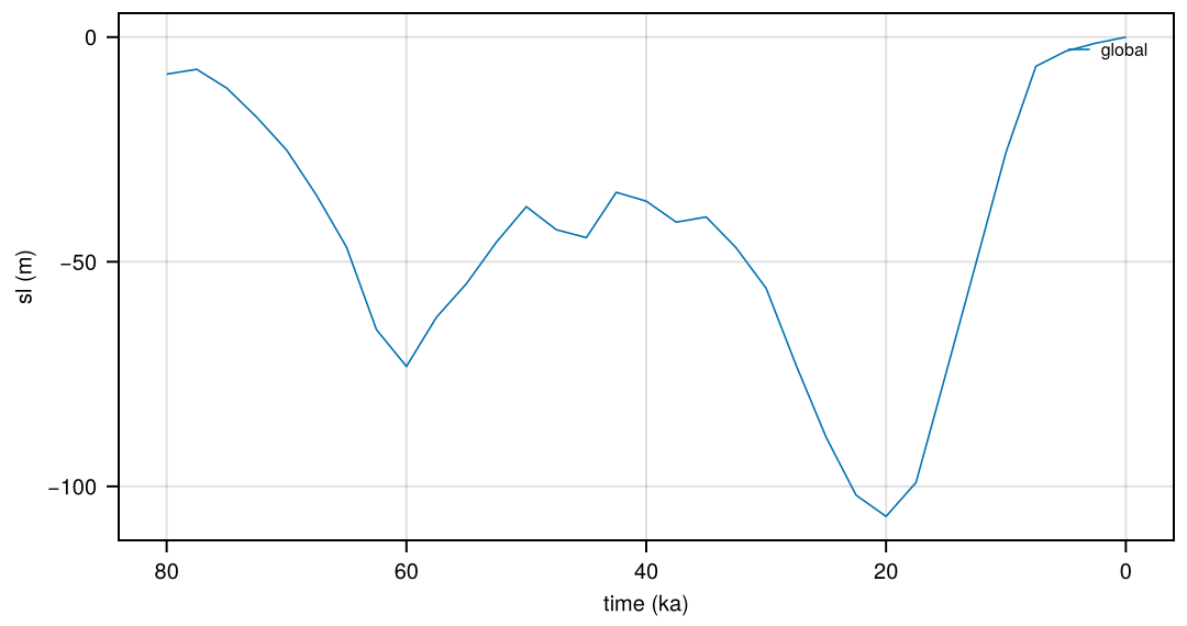
SeaLevel-PaleoMIST, SeaLevel-PaleoMIST_max |
Gowan et al. (2021): ice sheets of PaleoMIST 1.0, minimal and maximal MIS 3 scenarios, doi:10.1594/PANGAEA.905800 | sl, sl_nam (with Greenland), sl_eis, sl_ais, sl_pat |
0-80 ka, 2.5 kyr |
All are series of the region “global” without a location (featureType timeSeries, dimension region, lat and lon missing), except Grant et al. (2014), a time series at the Hanish Sill of the Red Sea (dimension station). time is in years before 1950 CE (units “years ago”), on the age model of the source (in the comment of time).
Conventions: sl is sea level relative to the present in m, negative when lower (e.g. about -120 m at the Last Glacial Maximum); sl_<ice sheet> is the contribution of an ice sheet to it, with the same sign (minus the change of its volume from the present, in m sea level equivalent). Sources with the opposite sign (Bintanja and van de Wal, 2008) or with total ice volumes (de Boer et al., 2014; Rohling et al., 2021) are converted; values at the present are kept as given, not set to zero (e.g. Spratt and Lisiecki, 2016: +8.5 m; Berends et al., 2021: -3.3 m). _sd is 1 sigma, _min and _max the bounds given by the source (see the long names).
Licences
| Source | Licence |
|---|---|
| Spratt and Lisiecki (2016), Waelbroeck et al. (2002), Bintanja and van de Wal (2008), de Boer et al. (2014), Rohling et al. (2021) | NOAA NCEI open data, no licence stated; publishing assumed to be allowed |
| Berends et al. (2021) | CC BY 4.0 (Zenodo) |
| Grant et al. (2014) | Supplement of a Nature Communications article, no open licence stated; publishing assumed to be allowed |
| Lambeck et al. (2014) | Supporting information of a PNAS article, no open licence stated; publishing assumed to be allowed |
| Gowan et al. (2021), PaleoMIST 1.0 | CC BY 4.0 (PANGAEA) |
Making the dataset
julia fesmdata.jl record SeaLevelprepares the missing sources (<Source>/prepare.jl), checks the prepared files and copies them to $FESMDATA_PRODUCTS/Records/SeaLevel/ with their text forms (--overwrite to replace them). PaleoMIST needs the archive of PaleoMIST 1.0 (3.5 GB, also used by IceHistory); Lambeck2014 a manual download (see its README) and pdftotext.
Downloads
Download the files with fesmdata.jl into $FESMDATA_PRODUCTS/<Domain>/<GRID>/ (see Download), or one by one from the links below. All released datasets are listed under Products.
Version 2.0.0 (2026-10-15, packages). 22 files, 15.3 MB.
julia fesmdata.jl fetch SeaLevel Records
SeaLevel 22 files, 15.3 MB
| SeaLevel-Berends2021.nc | 829.2 kB |
| SeaLevel-Berends2021.txt | 2.0 MB |
| SeaLevel-Bintanja2008.nc | 950.9 kB |
| SeaLevel-Bintanja2008.txt | 2.7 MB |
| SeaLevel-Grant2014-data.nc | 38.3 kB |
| SeaLevel-Grant2014-data.txt | 36.1 kB |
| SeaLevel-Grant2014-probabilistic.nc | 168.9 kB |
| SeaLevel-Grant2014-probabilistic.txt | 364.2 kB |
| SeaLevel-Lambeck2014.nc | 27.9 kB |
| SeaLevel-Lambeck2014.txt | 12.1 kB |
| SeaLevel-PaleoMIST.nc | 32.6 kB |
| SeaLevel-PaleoMIST.txt | 4.2 kB |
| SeaLevel-PaleoMIST_max.nc | 32.7 kB |
| SeaLevel-PaleoMIST_max.txt | 4.3 kB |
| SeaLevel-Rohling2021.nc | 205.4 kB |
| SeaLevel-Rohling2021.txt | 516.2 kB |
| SeaLevel-Spratt2016.nc | 61.7 kB |
| SeaLevel-Spratt2016.txt | 80.9 kB |
| SeaLevel-Waelbroeck2002.nc | 52.4 kB |
| SeaLevel-Waelbroeck2002.txt | 29.2 kB |
| SeaLevel-deBoer2014.nc | 1.5 MB |
| SeaLevel-deBoer2014.txt | 5.7 MB |
Figures
Berends2021
Bintanja2008
Grant2014
Lambeck2014
PaleoMIST
PaleoMIST_max
Rohling2021
Spratt2016
Waelbroeck2002
deBoer2014