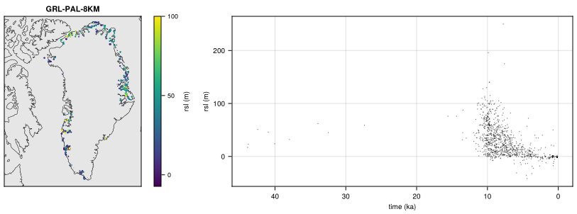
RSL: relative sea level indicators
Dated relative sea level indicators (index points and limiting data). RSL is a records dataset (non-gridded data, see Records): its products, defined in RSL/records.toml, are prepared files in the form of the CF discrete sampling geometries, written to $FESMDATA_PRODUCTS/Records/RSL/RSL-<product>.nc.
Products
| Product | Source | Region | Variables |
|---|---|---|---|
RSL-GAPSLIP |
GAPSLIP 2.1 (Gowan, 2023), doi:10.5281/zenodo.10121689 | Greenland: 1019 samples at 47 locations, up to 44 ka | rsl, rsl_min, rsl_max (m, 2σ), type (marine limiting, index point, terrestrial limiting), time, time_min, time_max (years ago, 2σ), lab_id, site_name, sector, reference |
Each sample is an observation (featureType point, dimension obs) with its lat, lon and time in years before 1950 CE (units “years ago”, calibrated ages).
Licences
| Source | Licence |
|---|---|
| GAPSLIP 2.1 (Gowan, 2023) | CC BY-SA 4.0 (repository; the Zenodo record states CC BY 4.0) |
Making the dataset
julia fesmdata.jl record RSLprepares the missing sources (<Source>/prepare.jl), checks the prepared files and copies them to $FESMDATA_PRODUCTS/Records/RSL/ (--overwrite to replace them).
Downloads
Download the files with fesmdata.jl into $FESMDATA_PRODUCTS/<Domain>/<GRID>/ (see Download), or one by one from the links below. All released datasets are listed under Products.
Version 2.1.0 (2026-10-15, packages). 2 files, 600.5 kB.
julia fesmdata.jl fetch RSL Records
RSL 2 files, 600.5 kB
| RSL-GAPSLIP.nc | 379.5 kB |
| RSL-GAPSLIP.txt | 220.9 kB |
Figures
GAPSLIP