Historical maps
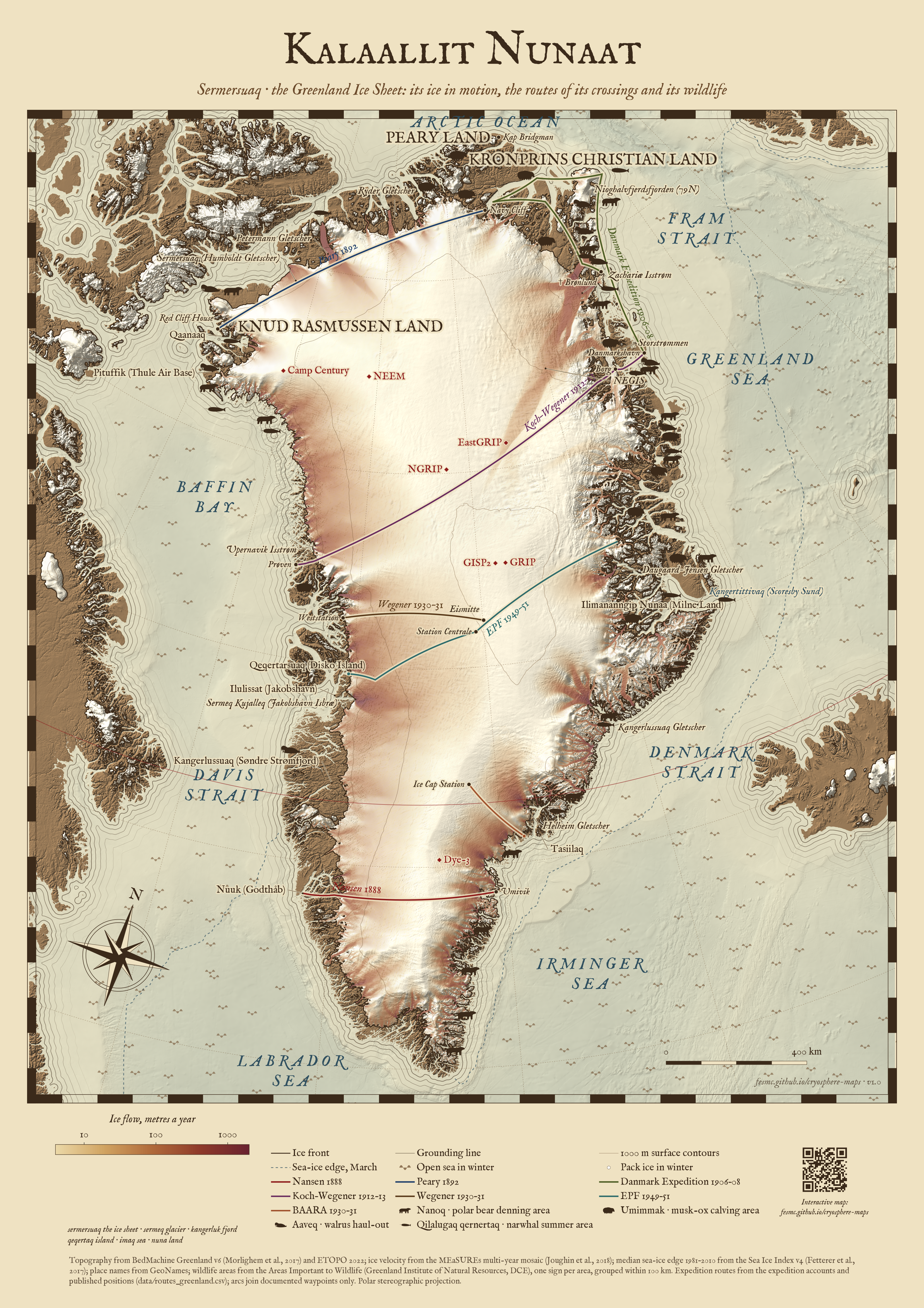
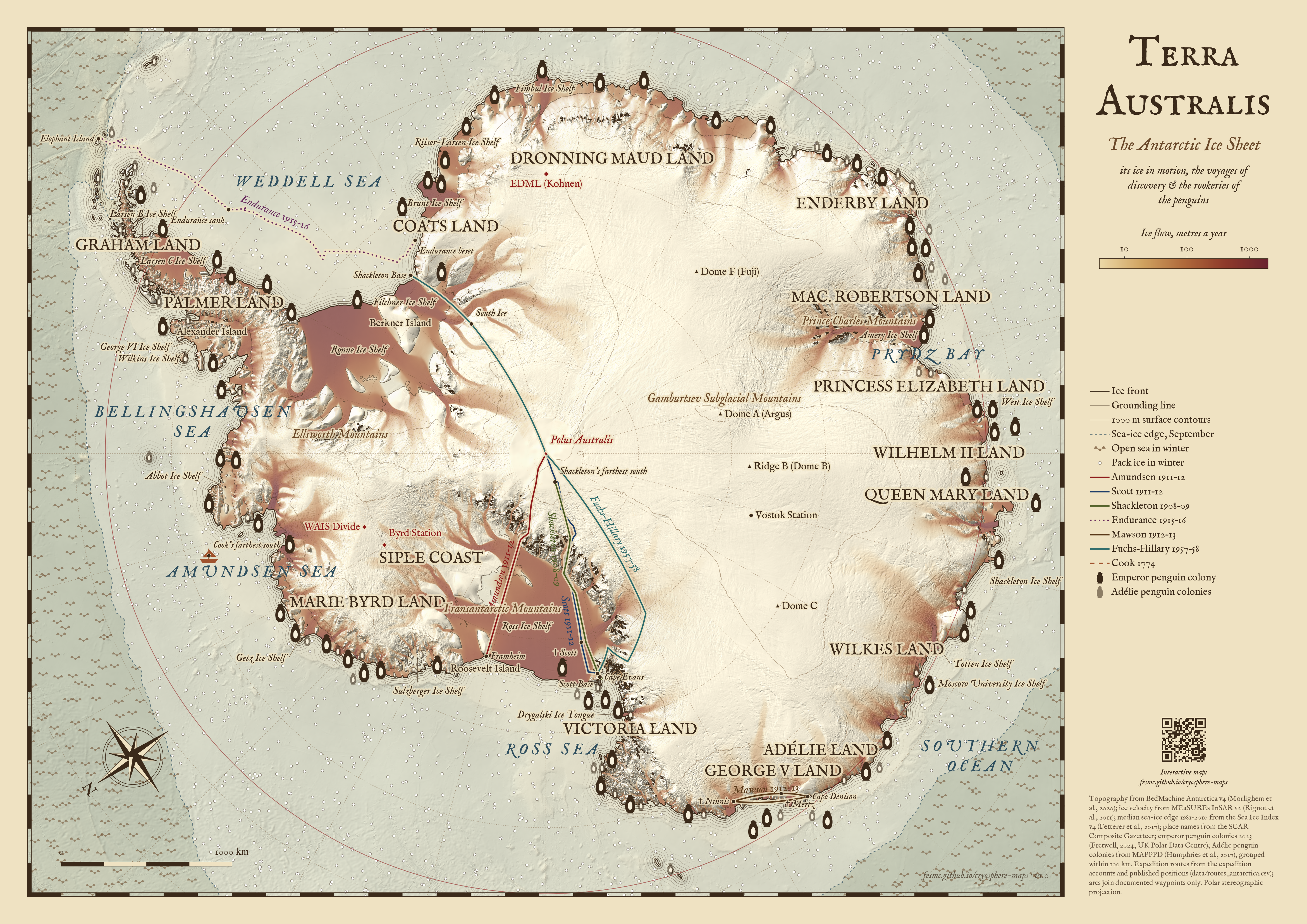
The ice sheets drawn as old charts, from the same data as the posters: ice flow in rust to oxblood over the hillshaded surface, water lining along the coasts, waves on the sea beyond the median winter sea-ice edge and floes inside it. On them are the routes of historical expeditions and where penguins breed and Arctic animals gather. The Greenland map uses Greenlandic (kalaallisut) names and terms: Kalaallit Nunaat is Greenland, “the land of the Greenlanders”, and Sermersuaq the ice sheet.
Maps
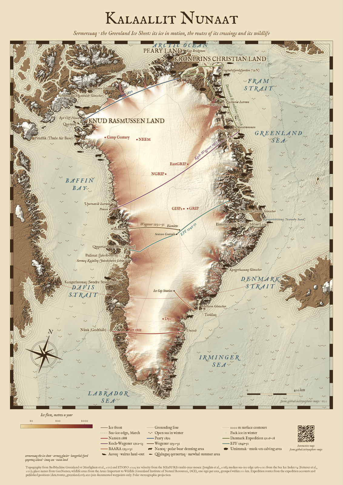
Greenland: old-world style · PDF, A0, 39 MB · PNG, 100 dpi, 17 MB
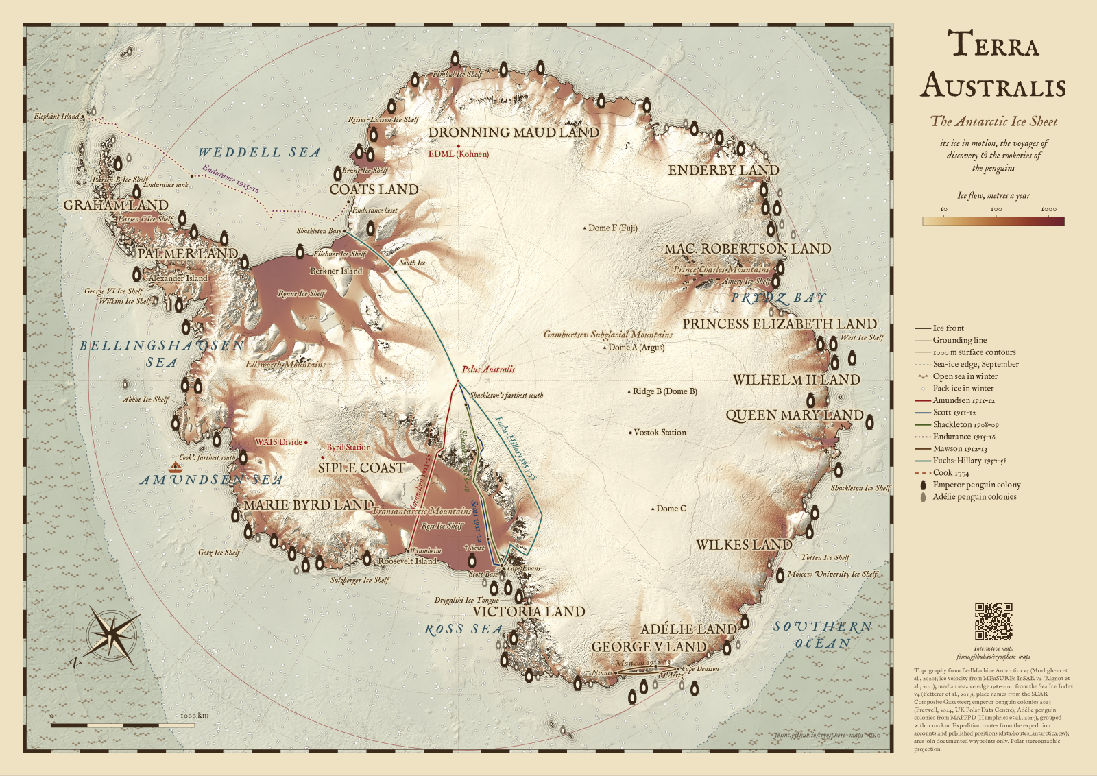
Antarctica: old-world style · PDF, A0, 41 MB · PNG, 100 dpi, 17 MB
Routes
The routes are transcribed from the expedition accounts and published positions; every point and its source are listed in data/routes_antarctica.csv and data/routes_greenland.csv.
- Along the route (camp and noon positions): Amundsen 1911–12 (The South Pole; Lantz, 2022, for the plateau), Scott 1911–12 (Scott’s Last Expedition; Debenham, 1923), Shackleton 1908–09 (The Heart of the Antarctic) and the drift of the Endurance and the boat journey to Elephant Island 1915–16 (South; Worsley’s log). Some longitudes are inferred from the stated course, as noted in the files.
- Documented places only, joined by arcs to show that the route between them is simplified: Mawson 1912–13, Fuchs–Hillary 1957–58, and in Greenland Nansen 1888, Peary 1892, the Danmark Expedition 1906–08, Koch–Wegener 1912–13, Wegener 1930–31, the British Arctic Air Route Expedition 1930–31 and the Expéditions Polaires Françaises 1949–51.
Wildlife
- Emperor penguin colonies in 2023 (Fretwell, 2024, UK Polar Data Centre, doi:10.5285/fb0547e4-d2c1-4580-8c98-182f1da7d9ae).
- Adélie penguin colonies from MAPPPD (Humphries et al., 2017, penguinmap.com), grouped within 100 km.
- Greenland: polar bear denning, musk-ox calving, walrus haul-out and narwhal summer areas from the Areas Important to Wildlife (Greenland Institute of Natural Resources and DCE, Aarhus University), one sign per area, grouped within 100 km.